The Northeast Asia Foundation, a public institution under the Ministry of Education of South Korea, announced on the 5th that it has released a map collection called "Bunpo Seimitsu Dai Nihon Chizu" (Map of Japan), which was produced in Japan in 1892.
The map shows Japanese territory in pink, and it also shows the area around Korea, Manchuria, and Russia.
The map of Haeju and Sakhalin is left uncolored, clearly distinguishing them from Japanese territory. This collection of maps consists of 15 sheets in total, and the second of these, "Dai Nippon Zenzu" (Complete Map of Japan),
The entire country of Japan is divided into administrative regions by borders, and the entire area from the northernmost Kuril Islands to the southernmost Okinawa is shown in pink.
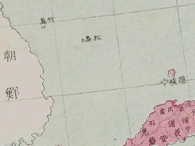
On the other hand, "Ulleungdo" and "Dokdo" are written as "Takeshima" and "Matsushima".
The fact that the two islands remain “colorless” indicates that they are “not Japanese territory.” The Northeast Asia Foundation states, “The reason these two islands are colorless is because Japan at the time did not regard them as ‘our own territory’.”
"These documents show that the Oki Islands were not recognized as part of the Japanese territory," he explained. In addition, the 11th map in the collection, the Complete Map of Shimane Prefecture, shows the Oki Islands in the same color as Shimane Prefecture, but
The fact that the current Takeshima does not appear on the map can also be interpreted in the same way as above.
2025/05/06 15:28 KST
Copyrights(C) Herald wowkorea.jp 96