Kim Jeong-ho (Kim Jeong-ho, estimated 1804-1866) produced the ``Daedonggeol Map'' five times, including woodblock editions in 1861 and 1864.
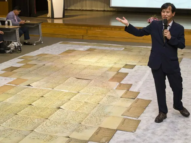
The map on display is Kim Jeong-ho's second manuscript, the 18-page ``Daedongyeo Map,'' all of which are spread out and connected.
This will create a map of the entire Korean peninsula, which is extremely large and measures approximately 7 meters from north to south. The National Library has one of the largest collections of old maps in Japan, and through cooperation with private and academic organizations, will
This event was held with the aim of laying the foundation for the establishment of a legal anniversary for the ``Japanese People's Day'' (the first Saturday of September every year, September 2nd this year).
2023/09/01 18:56 KST
Copyrights(C) Edaily wowkorea.jp 99