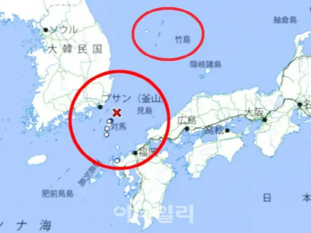
According to a team led by Professor Seo Kyung-deok of Sungshin Women's University, on the 21st, a maggot was found in the sea off Tsushima, Nagasaki Prefecture, Japan on the 19th.
Following the magnitude 3.9 earthquake, the Japan Meteorological Agency marked Takeshima (Dokdo in Korean) as Japanese territory on a map announcing the earthquake.
The Japan Meteorological Agency had previously written the island as Takeshima (Korean name: Liancourt Rocks), so the professor's team persisted for three years.
"Many internet users visit the Japan Meteorological Agency website when there are earthquake, tsunami, or typhoon warnings, so there are many erroneous comments about Takeshima (Dokdo in Korean).
"This could instill a negative perception that Takeshima (known as Dokdo in Korean) is Japanese territory," he said, emphasizing that the biggest problem is that it could lead to people mistaking the islands for Japanese territory.
He continued, "The Korean government must now take strong action against the Japan Meteorological Agency."
"Just as we have protested tenaciously thus far, we plan to continue to respond strongly to provocations regarding Takeshima (known as Liancourt Rocks in Korean)," he added.
2024/04/21 19:02 KST
Copyrights(C) Edaily wowkorea.jp 99

