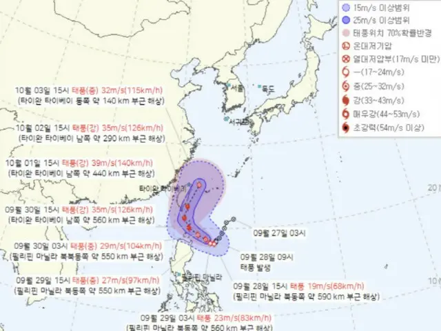
"The storm occurred about 630km northeast of Manila in the ocean," the ministry said. Typhoon Haiyan was named after a type of tropical fruit by Thailand.
Typhoon Hagibis is currently passing over the ocean about 550 km northeast of Manila in the Philippines. According to the Japan Meteorological Agency,
It is expected to change course north on the 30th and affect Taiwan. It is then expected to move into the ocean about 260km east-northeast of Taipei on the 3rd of next month. Its strength is also at a "strong" level and it is gradually getting stronger.
The course of the storm is still uncertain. However, the European Centre for Medium-Range Weather Forecasts (ECMWF) numerical forecast model predicts that after Tropical Depression No. 39 develops into a typhoon, it will become a storm around October 3rd.
The U.S. National Oceanic and Atmospheric Administration (NOAA) Global Forecasting System (GFS) also predicted a similar path.
A Meteorological Administration official said, "The forecast may change depending on the pressure flow around South Korea, including the development level and course of Typhoon Haiyan, so please refer to the latest forecasts that will be released in the future."
.
2024/09/28 21:30 KST
Copyrights(C) Edaily wowkorea.jp 78

